


The Power of 3D Concepts in Smarter City Planning
Discover how 3D concepts improve smarter city planning with better visuals, public input, and sustainable urban development tools.
As cities grow bigger and more complex, urban planning becomes more challenging. Planners, architects, and governments need better tools to design spaces that are smart, efficient, and sustainable. This is where 3D concepts are making a big difference. By using 3D tools and technologies, cities can plan better, save time, and make smarter decisions that improve life for everyone.
In this article, well explore what 3D concepts mean, how they work in smart city planning, and why they are important for the future of urban development.
What Are 3D Concepts in Urban Planning?
3D concepts are digital tools that help us create three-dimensional (3D) views of buildings, roads, parks, and entire neighborhoods. These are more advanced than traditional 2D maps. They allow planners and designers to see the city in a real-life-like way before anything is built.
There are several types of 3D technologies used in city planning:
-
3D Modeling A digital model of buildings and spaces.
-
3D Visualization Turning models into photo-like images to see how a space will look.
-
Digital Twins A virtual copy of the real city that updates in real time using data.
-
BIM (Building Information Modeling) A tool to design and manage buildings using 3D information.
These tools make it easier to plan smarter, greener, and more connected cities.
Why Are 3D Concepts Important in Smart City Planning?
Smart cities are places that use technology and data to make life better for people. They focus on things like traffic control, clean energy, safety, public transport, and good living spaces. To plan these cities, decision-makers need to understand how different systems will work together and thats where 3D tools are helpful.
Heres how 3D concepts support smart city planning:
1. Better Visualization and Communication
One of the biggest benefits of 3D concepts is that they make it easier to see and explain ideas. For example, if a city is planning a new park or transport system, they can use 3D images to show how it will look and work. This helps people understand the plan clearly even if they are not architects or engineers.
2. Smarter Decisions with Simulations
3D models can also run simulations. Planners can test different designs to see what works best. They can study how people will move, how much sunlight buildings will get, or how rainwater will flow. These tests help avoid problems before construction starts.
3. Public Engagement
3D visuals make it easier to involve citizens in planning. Instead of showing complex maps or text documents, cities can show a 3D walkthrough of a project. This builds trust and allows people to share their ideas early on.
Real-Life Examples of 3D in Smart Cities
Lets look at some real-world examples of how cities are using 3D concepts:
Singapores Virtual City
Singapore has created a digital twin called Virtual Singapore. It is a full 3D model of the city that includes buildings, roads, trees, and more. It helps planners test ideas for transportation, energy use, and emergency planning. It even allows them to test how the city would react in a natural disaster.
Helsinkis Smart District
In Helsinki, Finland, a district called Kalasatama uses 3D planning to improve energy use and public services. The city tests different layouts using digital tools and includes people in the design process with 3D visualizations.
New York Citys 3D Zoning Tool
New York uses 3D tools to explain zoning laws. This helps developers and residents see what can be built on a piece of land. It saves time and reduces confusion.
How 3D Concepts Help with Sustainability
Cities today are focusing more on eco-friendly planning. 3D tools play a big role in this because they help planners design with the environment in mind. For example:
-
They can test how much sunlight a new building will block.
-
They can study wind and air flow through streets.
-
They can plan for green spaces like parks and gardens.
-
They can test how much energy a building will use.
By using this data, cities can reduce carbon emissions and create better living environments for everyone.
The Role of Digital Twins
A digital twin is a special kind of 3D model. Its not just a picture its a live, working version of a real city. It connects to data from traffic cameras, sensors, and weather systems. This helps city managers make real-time decisions.
For example, if traffic is heavy in one area, the system can suggest changes to traffic lights. Or if pollution levels rise, it can warn people and take action.
Digital twins are becoming a big part of smart cities because they help cities respond quickly to changing needs.
Improving Accessibility and Safety
3D planning also helps create cities that are safer and more inclusive. Designers can use it to:
-
Test how easy it is for people with disabilities to move around.
-
Plan for safe walking paths and better lighting.
-
Make sure emergency services can reach all areas fast.
By focusing on peoples needs, cities become more welcoming and easier to live in.
What About the Challenges?
While 3D concepts are powerful, they also come with challenges:
-
High Costs: Creating 3D models and digital twins can be expensive.
-
Training: Staff need to learn how to use the tools.
-
Data Privacy: When using real-time data, privacy must be protected.
-
Software Compatibility: Different systems may not work well together.
Still, many cities find the benefits are greater than the problems. New tools are becoming more affordable and easier to use.
The Future: AI, VR, and More
The future of smart city planning will go beyond 3D models. New technologies are being added, such as:
-
Artificial Intelligence (AI): AI can help design cities faster and smarter by analyzing large amounts of data.
-
Virtual Reality (VR): VR allows people to walk through planned spaces before theyre built.
-
Augmented Reality (AR): AR shows extra information about real spaces using a phone or smart glasses.
These tools will make planning even more interactive and efficient.
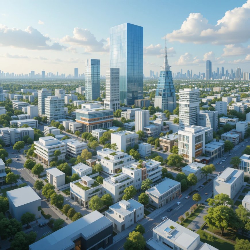
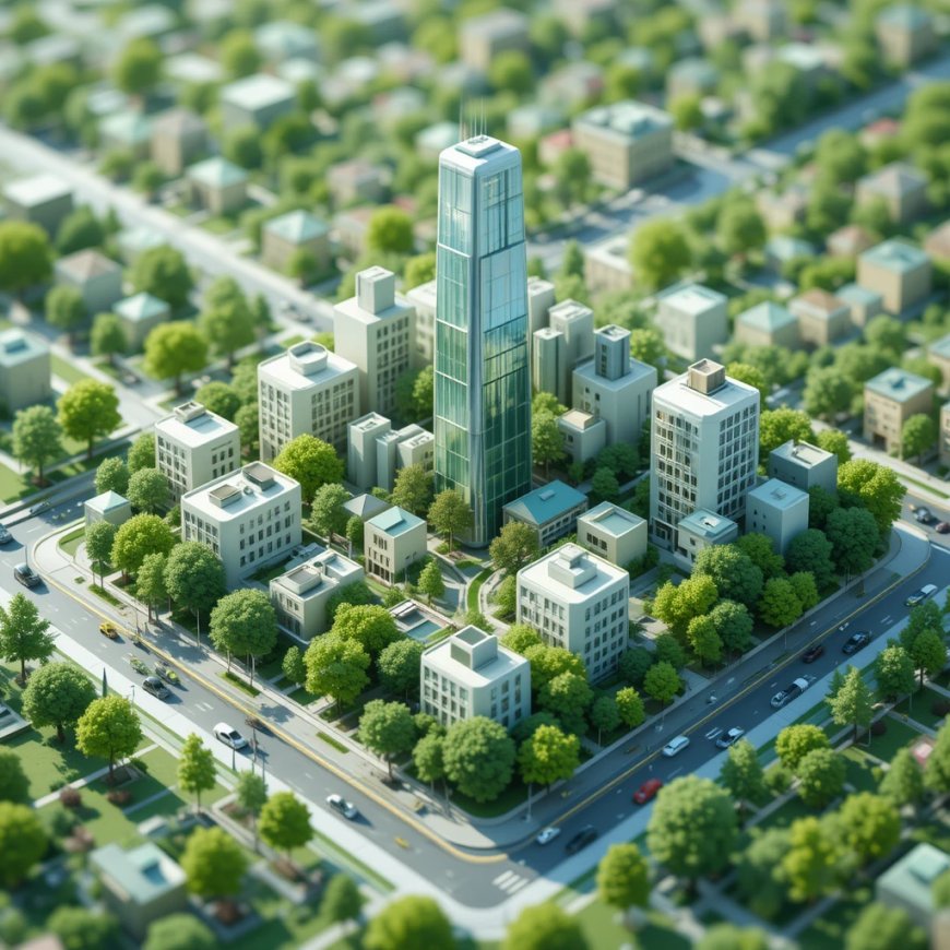
How 3D Urban Renderings Make a Difference
One important part of 3D concepts is rendering. This is when a 3D model is turned into a high-quality image that looks real. These images help people see exactly what a new building or area will look like.
Professionals use 3D urban renderings to show complete city designs in detail. This helps win public support, attract investors, and get approvals faster. Its a key part of making smart city plans successful.
Conclusion: 3D Is Shaping the Future of Cities
The way we plan cities is changing fast. 3D concepts are helping us build better, smarter, and more sustainable places to live. From virtual twins to visual simulations, these tools give us the power to see problems before they happen and make smarter choices.
As technology continues to grow, cities that use 3D planning will be better prepared for the future. Theyll be more connected, more efficient, and more comfortable for the people who live there.